
Research
The lead mines
In the riera de Pontons, within the municipal area of Pontons, lead and zinc ores were mined. Two 19th-century accounts describe the mines and a cavity with human remains, called les Calaveres. The 1934 documents and current inventories make it possible to cross-check the names and location. Still to be resolved are the correspondence between concessions, the dating of the closures and the state of the cavity.
In the municipal area of Pontons, near the boundary with Torrelles, there were lead and zinc mines. This is the story of how they have been located again, and of a bone-filled pothole that still gives its name to one of them: the mina de les Calaveres.
1870-2026 12 references 39 citations
Research index
00 · Before anything else
This is Pontons' municipal areaSome mines in the municipal area of Pontons
First, a clarification: this is an archive of Torrelles, but the mines are not in Torrelles' municipal area. They are in that of Pontons, just before the boundary.
We discuss them here for three reasons. The two hikers who described them arrived from Torrelles, up the stream. The road that ran alongside them is the one from Pontons to Torrelles de Foix. And the complaint that led to the order to close their mouths refers to that same road.
It's worth stating from the outset, because this is an archive of Torrelles and the mines are not in the municipal area: they are in that of Pontons, just before the boundary.
They are here all the same because the two hiking accounts studied arrive from Torrelles and up the stream, because the road that ran alongside them is the one from Pontons to Torrelles de Foix, and because the complaint that led to the closure order refers to this road linking the two villages. This study should be read together with Pontons' own documentation and research.
The documented stages
- 1870The mina Esperanza
The heritage record includes José Cirera's application.
- 1885–1889Two accounts
Gomis describes five mines; Castellanos places the area between two chapels.
- 1927–1934Concessions and closure
Application for a change of holder and lapse of the concession; order to close shafts and galleries.
- 2013–2026Recent inventories
Speleological surveys and records of the surviving heritage.
01 · 1885
Five mines and a local name for galenaFive abandoned mines
In December 1885, the writer Cels Gomis went up to the village and wrote everything down. A quarter of an hour above the Mas de la Riera, he visited five mines of lead and calamine (zinc ores). All were abandoned.
Gomis also noted what local people called galena, the lead ore they extracted: barnís. The word goes back a long way: an index of documents copied in the 18th century already mentions extracting "vernís" and lead from the Pontons mine.
Cels Gomis i Mestre (1841-1915), writer and folklorist, professionally linked to engineering works, goes up to the village in December 1885 and writes everything down: the stones, the songs, the superstitions and what people tell him along the way. The account is published in 1888. Between Torrelles and Pontons, a quarter of an hour above the Mas de la Riera and on both sides of the stream, he finds lead and calamine mines. He visits five.
- La Esperanza
The main one
It had defrauded its shareholders. The calcining furnace, the reverberatory furnace and the outbuildings could still be seen, completely abandoned.
- Abundante
Left bank
One of the two that Gomis names on the left bank of the stream.
- Esperanza
Left bank
With the same name as the main one, but without the article: that is how it is recorded.
- Two more
Unnamed
Gomis says he visited five and names only three. The other two are not named in the article.
He gives measurements for what was extracted. The lead sulphide (galena) came in veins one to four fingers thick, with the occasional nodule a hand-span wide, and it was said that pockets of four hundred hundredweight and more had been found. Calamine, the traditional name for oxidised zinc ores, including carbonates, came in veins thirty to fifty centimetres wide. Also present were blende, iron oxide and, on the right bank, arsenical galena.
And he records the word local people use for galena: barnís. The use of the same word by Castellanos, together with the place references, helps to link the two accounts.
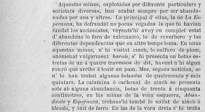
And that word goes back a long way. The index of the Pontons cartulary, copied in the 18th century, has an entry that reads: "Una Executoria del Senyor Intendent de Cathalunya pera traurer Vernis, y Plom de la Mina de Pontons". Vernís is the same word as barnís, and it means that the monastery held documentation on lead extraction in Pontons predating Gomis's account, and that the monastery of Santes Creus kept the document. The volume never got around to copying the document: the page column is blank. See La ratlla de ponent.
Gomis also describes the end of the workings he visited: they were worked by various private individuals and companies, and all of them ended up abandoning them. Gomis's account presents them as abandoned in 1885; the remains he describes show they had not disappeared.
02 · 1885
"Las Calaveras"A cave full of bones
Gomis was told that, on opening up a gallery of the La Esperanza mine, the miners had come across a cave. He states that he went in himself, partly crawling on his belly. The bottom of the pothole was full of human bones, damaged by the miners themselves. It was already known as "Las Calaveras".
Was it a burial place, or had someone thrown their victims in there? Gomis wrote that it could no longer be known: the skeletons were smashed to pieces. That they were prehistoric, as has been claimed since, is not proven by any known archaeological analysis.
The same article describes a find of human remains inside a mine. He is told of it by Salvador Morgades, alias Serarols, a former foreman of the mina La Esperanza: on opening one of the cross galleries, the miners came upon a large cave.
Gomis states that he went in personally. In the following excerpts the spelling has been modernised; the facsimile allows the original text to be consulted.
I wanted to see it for myself and, although some distance has to be covered crawling on one's belly, I have myself guided to the said cave, known today as Las Calaveras.
He describes it as a natural cavity some five to six metres high and three and a half in diameter, its walls covered in calcareous concretions, "one of which fairly closely resembles a human face". And the bottom:
The bottom of this cave, or rather of this pothole, is full of human bones broken up by the miners themselves.
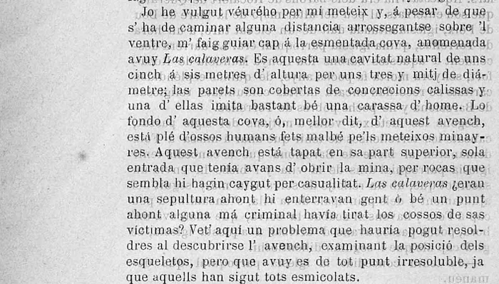
The pothole was sealed at the top (the only entrance it had had before the mine broke into it from the side) by rocks that seem to have fallen there by chance. Gomis wonders whether "Las Calaveras" was a burial place where people were interred or a spot where some criminal hand had thrown the bodies of their victims. And he answers:
Here is a problem that might have been solved when the pothole was discovered, by examining the position of the skeletons, but which today is quite unsolvable, since they have all been smashed to pieces.
The account places access to the pothole via a gallery of La Esperanza in December 1885. It does not allow its present state to be established, nor its identification with the caves of Batlle Vell, d'en Bram or del Pany. Nor does it allow the human remains to be dated: the description of them as "prehistoric" found in later accounts is not based on any known archaeological analysis.
03 · 19 August 1889
Two chapels to find them byBetween two chapels
In August 1889 another hiker passes through, Josep Castellanos. He leaves Torrelles before dawn, riding a donkey, and goes up the stream counting the minutes. Ten minutes past the Mas de la Riera, he passes above the mines.
And without meaning to, he leaves written down two clues that still exist: on the other side of the stream, perched on the cliff, the chapel of Sant Joan de Pontons, and to the right, the ruins of that of Sant Salvador. These two chapels have been used to work out where the mines stood.
Almost four years later, in August 1889, Josep Castellanos passes through. He leaves Torrelles at half past three in the morning with the heir of Can Fanas; Castellanos says he is travelling on a donkey and feeling seasick, and goes up the stream along the left bank. He counts the minutes: at twenty, the path up to the old parish church; at twenty-five, les Dous, "a group of four houses"; at thirty and at thirty-seven, two wooden footbridges for crossing the stream; around fifty-five, the mill at the Mas de la Riera.
«A abdós costats de la riera s'alsan enlayradas cingleras formadas d'inmensos blochs calcaris horisontals. La riera, en lo fondo del barranch, salta de roca en roca, y reb á cada pas lo tribut de fonts y torrents.» The description is consistent with the Muschelkalk materials identified in this area, but the hiking account is not a geological study.
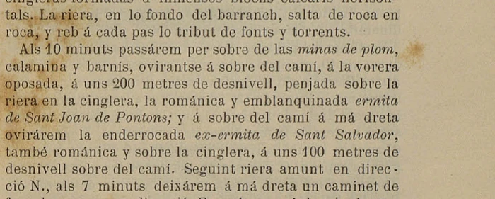
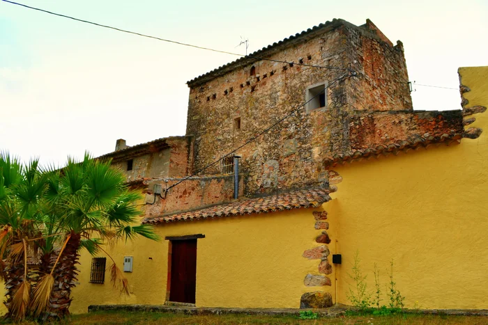
At fifty-five minutes he reaches the mill of Mas de la Riera and, two minutes later, the "grand house of Mas de la Riera". The farmhouse survives and helps to trace the route.
Ten minutes after Mas de la Riera he passes above it, and gives the two reference points that change everything:
At 10 minutes we passed above the lead, calamine and varnish mines, glimpsing above the path, on the opposite bank, some 200 metres up the slope, hanging over the stream on the cliff, the Romanesque, whitewashed chapel of Sant Joan de Pontons; and above the path to the right we glimpsed the ruined former chapel of Sant Salvador, also Romanesque and on the cliff, some 100 metres up the slope above the path.
The vocabulary and the geographical references match the mining area described by Gomis. And, without meaning to, he leaves written two references that still exist today. They are these:
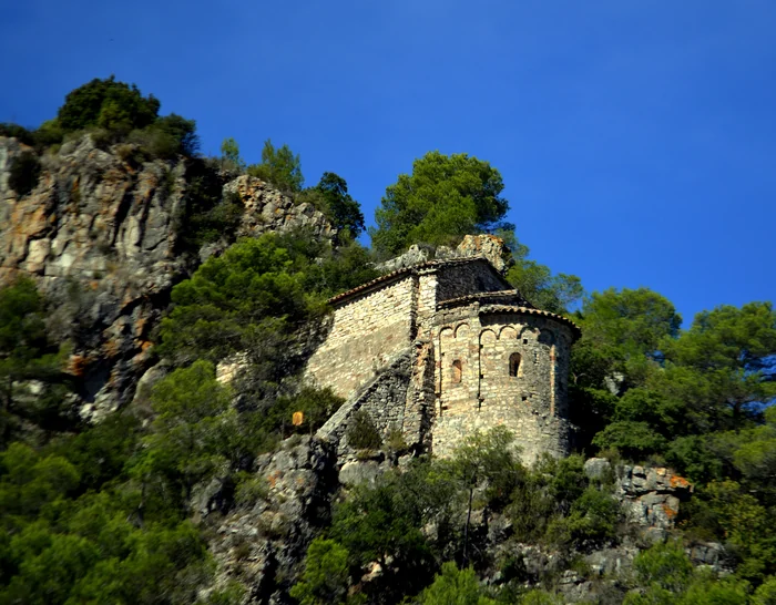
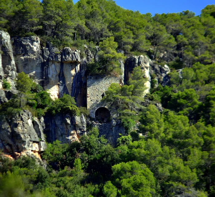
Both photographs date from 2012 and are published by Angela Llop under a free licence. It is worth viewing them alongside the 1889 text: they allow the two buildings to be identified and the references in the account to be checked. They do not reproduce the exact viewpoint of the 1889 path.
04 · 1927
An English company based in LondonAn English company
From 1889 to 1927 there is only second-hand information. It speaks of an English company that worked there, but the accounts do not agree on the dates.
On 15 November 1927, Pau Lluís Weell requested that three mines in Pontons be registered in his name: "Mascota", "Mascota 2a" and "Teresa". He said he had bought them from that company, based in London. But by the end of the year the concessions had lapsed over an unpaid fee, a levy, and the mines were abandoned without their shafts being closed.
For the period between 1889 and 1927 we have secondary accounts that do not fully agree on the mining activity. An image of the stream also survives: the physician and photographer Josep Salvany passed through in 1913 with a stereoscopic glass-plate camera.
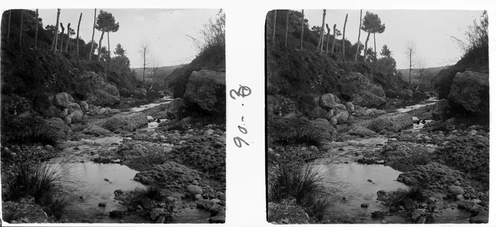
The caving group that worked there in 2013 dates the English company's activity to 1912, its halt to August 1914 and its liquidation to 1918. The heritage records, however, place the start of the English operation during the First World War. The discrepancy needs to be settled with company records; the 1934 order gives no dates for its formation or liquidation.
The official gazette does document the request to change ownership and the lapsing of the concessions.
On 15 November 1927, Pau Lluís Weell, residing at Hotel Continental, Barcelona, requested that the mines "Mascota", "Mascota 2a" and "Teresa", in the municipal area of Pontons, be registered in his name. He said he had bought them from The Pontons (Spain) Zinc Lead Mines Limited, an English company based in London.
The three concession names do not match those given by Gomis. It has not yet been established which concession corresponds to which entrance; the difference in names does not by itself prove a re-registration of the same mines. The document does, however, confirm the link between the concessions and a company based in London.
The requested registration did not prevent the concessions from lapsing at the end of that same 1927 owing to unpaid surface fees, and they were abandoned without complying with article 56 of the Mining Police Regulation, which is what requires shafts to be closed.
05 · 27 February 1934
"Mine entrances used as shelter"The order to seal the entrances
In 1934, the Mayor's Office of Pontons reported that beside the road from Pontons to Torrelles de Foix there were open mine entrances where people were taking shelter, and that people were uneasy about passing that way.
The Barcelona Mining District gave Pau Lluís Weell, who had applied for the mines in 1927, thirty days to properly seal the shafts and galleries. If he did not, the Administration would do it at his expense. But the order does not prove that the entrances were actually sealed.
Seven years later, the Mayor's Office of Pontons reported what everyone could see from the road:
In view of the complaint lodged by the Mayor's Office of Pontons, that in that municipal area, beside the road running from Pontons to Torrelles de Foix, there are mine entrances used as shelter by vagrants and people of ill repute, and that people are loath to travel along the said road.
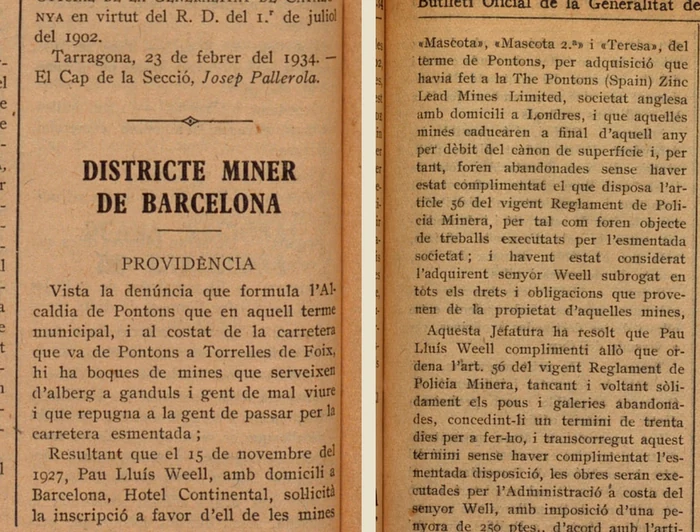
The Barcelona Mining District ruled that Pau Lluís Weell must comply with article 56, "solidly sealing and fencing off the abandoned shafts and galleries", and gave him thirty days. If he did not, the works would be carried out by the Administration at his expense, with a deposit of two hundred and fifty pesetas.
The order documents a municipal complaint about accessible entrances being used as shelter, and an order to seal them. The disparaging language of the complaint belongs to the document and does not neutrally describe the people who were staying there. The order does not prove that the works were carried out, nor does it allow the surviving blockings to be dated.
06 · 2026
How they were located: the two chapels are still thereTwo chapels on the map
Castellanos's two chapels are still there, and can be placed on a map. Finding the point on the stream closest to each one, and comparing the elevation differences with the ones he gave, yields a stretch of stream of about three hundred metres, with both banks. The left and right references in his account also fit.
This is a hypothesis worked out on the map, without visiting the site: it indicates where to look, not where each mine is.
In addition to Gomis's time-based reference ("a quarter of an hour above Mas de la Riera"), the two chapels that Castellanos gives as landmarks can be placed on a map, and an elevation map allows the approximate gradients he describes to be checked.
The two chapels
- 700 m
Sant Joan de Pontons
Today Sant Joan de la Muntanya. 41.408003 N / 1.524991 E. Nearby, the place name "Roques de Sant Joan": the cliff that Castellanos describes.
- 660 m
Sant Salvador de Pontons
41.412609 N / 1.532615 E. With "Roques de Sant Salvador" alongside.
The point on the stream closest to each one
Projected onto the geometry of the Pontons stream, the points closest to the two chapels lie about one hundred and twenty-five metres apart. The closeness of the two points helps to propose a search area, but the nearest projected point is not the same as the point from which a walker sees a chapel. The path would need to be reconstructed and its sightlines checked.
| Chapel | Point on the stream | Elevation | Estimated gradient | What Castellanos said |
|---|---|---|---|---|
| Sant Joan | 41,409099 / 1,530381 | 537 m | 163 m | "about 200 metres" |
| Sant Salvador | 41,410218 / 1,530171 | 532 m | 128 m | "about 100 metres above the path" |
The figures are of the same order of magnitude as Castellanos's. However, the elevation model has limited precision, and the point being compared is the stream, whereas the hiker speaks of the path. No precise error margin can be worked out from this.
A check on orientation
Castellanos states three checkable things: that he goes up along the left bank, that Sant Joan is on the opposite bank, and that Sant Salvador is on the right-hand side. The Pontons stream flows from the north-west towards the south-east, so heading upstream on this stretch means moving north-west. If "left bank" is understood in the hydrographic sense, it corresponds to the north-east side.
Walking north-west along the north-east bank, his right hand points north-east: and Sant Salvador lies east of the stream. The opposite bank is the western one: and Sant Joan lies to the west. The orientations are consistent with the proposed area. This is an additional clue, not an exact location.
The result: the stretch of stream around 41.4096 N / 1.5303 E, at 531–537 metres above sea level. In round numbers, from 41.4085 to 41.4110 latitude along longitude 1.530: an area some three hundred metres from north to south, with both banks. Municipal area of Pontons.
The hypothesis has been checked against records and photographs from the Mapa de Patrimoni Cultural. No fieldwork of our own has been carried out.
07 · The check
The listed mines: which is whichThe Calaveres mine
The Diputació de Barcelona heritage inventory records three mines in the area and the bridge of les Mines. The point calculated from the chapels falls sixty-three metres from one of the entrances.
One record ties the whole story together: the Esperanza mine, applied for in 1870, is known today as the mina de les Calaveres. The name of the bone-filled pothole passed to the mine and is still used. Both its entrances are bricked up, but it is not known whether this is the sealing ordered in 1934.
The Mapa de Patrimoni Cultural de la Diputació de Barcelona includes three mine records for this area. They belong to the municipality of Pontons, the oldest dates from November 2024 and the latest revision is from May 2026. All three are mines. And there is a fourth, for a bridge.
Same area, different mines
- 1Mines de Pontons
- 2Pont de les Mines
- 3Mines de les Calaveres
- 4Roques del Pany mine
| Item | Record | Coordinates | From the calculated point | What is there |
|---|---|---|---|---|
| Mines de Pontons, at roques de Sant Joan | 08168-164 | 41,40904 / 1,53040 | 63 m | entrance beneath a rock shelter; the record disagrees on whether the door survives |
| Pont de les Mines | 08168-165 | 41,40988 / 1,53033 | 31 m | the road bridge over the stream |
| Mines de les Calaveres | 08168-79 | 41,40764 / 1,53263 | 292 m | two entrances at the roadside, bricked up |
| Roques del Pany mine | 08168-173 | 41,40501 / 1,53757 | 793 m | entrance with a round arch, covered in vegetation |
The point that results from projecting Castellanos's two chapels onto the stream falls sixty-three metres from a listed mine entrance and thirty-one metres from a bridge called the Pont de les Mines. The closeness supports the area hypothesis, but the whole group extends some eight hundred metres downstream, from the entrance beneath the rock shelter to the Mina de les roques del pany.
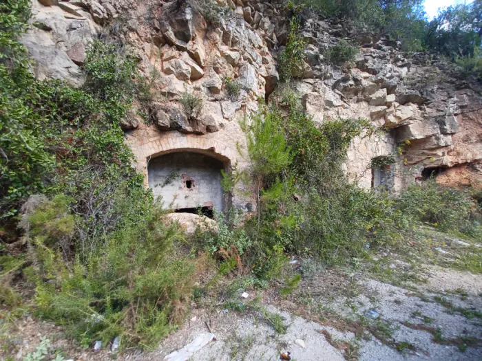
The name has survived a hundred and forty-one years
The record for les Calaveres carries a two-line note that ties the whole article together:
On 27 August 1870, José Cirera filed the request for possession of the lead and calamine mine named Esperanza, although it is now known as mina de les Calaveres.
And the cavers who went in there in 2013, without citing Gomis, explain the reason in the same words he used:
The name comes from the fact that at the end of the 19th century supposed "skulls of prehistoric men" were found when the miners came across a natural void inside the mine.
- 1870
Request concerning the Esperanza mine
On 27 August, José Cirera requests possession of a lead and calamine mine called Esperanza.
- 1885
Gomis finds La Esperanza there
The main one of the five. The former foreman tells him that while opening a cross gallery they came across a pothole full of bones, "known today as Las Calaveras".
- 2013
La Esperança, surveyed
A caving group surveys 1,414 metres of galleries there and records the same story of the skulls in their research report.
- 2024
The record states it in writing
The 1870 Esperanza mine "is now known as mina de les Calaveres".
The name that miners gave to a bone-filled pothole in the 19th century passed to the mine and is still used. The match between Esperanza and les Calaveres is strong evidence for locating the cavity described by Gomis within that mine. Its preservation and exact position still need to be checked.
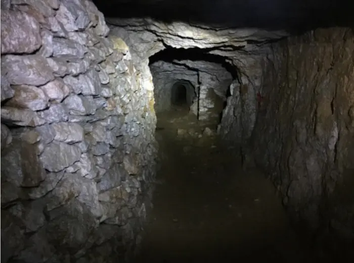
Closures still undated
The research asked whether the order to seal the entrances had been carried out. The record describes it as follows:
Two entrances opened into the mountainside, with a shallow arch built of bricks laid on edge, about 5 m high by 3 m wide. Both are bricked up with flat bricks and cement rendering, although they have later openings caused by vandalism that reveal the access and extraction tunnel cut into the rock.
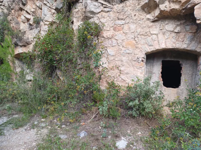
This must be said precisely: this does not prove that the brickwork dates from 1934. It could be later, and no one has dated the mortar. The record documents closures, but does not link them to that order. Its age cannot be calculated, nor can compliance with the 1934 order be taken as proven.
The other two entrances
The other two entrances lie away from the road. The records note that there were doors or protective features, but the descriptions do not entirely match later observations. The one beneath the rock shelter, at roques de Sant Joan, is described as an opening reinforced with stone and mortar, with a gallery cut into the rock without any props.
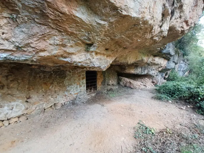
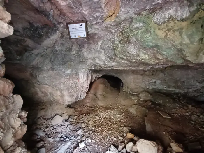
This one, and the one at roques del pany, were closed with a metal door and an information panel to create a geological heritage conservation area and a shelter for protected bats. Cavers date the grille to around 2013 and attribute it to the Agents Rurals. The record's revision of 22 May 2026 states that both the door and the panel have disappeared.
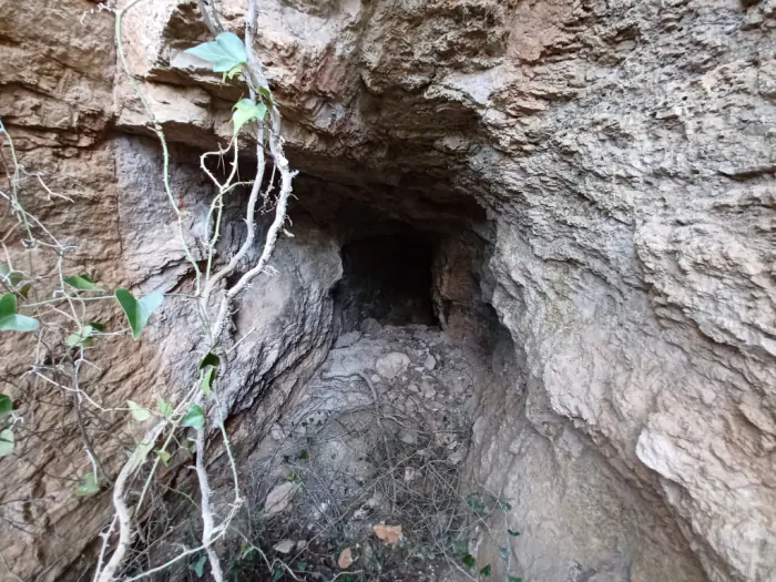
Two and a half kilometres of galleries
In November 2013 a caving group published a progress report on the work it was carrying out there. They had gone in looking for caves and found mines instead.
- 1.414 m
Mina Esperança
Les Calaveres. Thirty-one metres of negative elevation change. It is the largest and, they say, probably the first to be worked.
- 860 m
Mina núm. 2 de la Riera de Pontons
Its name is not known. The correspondence with the heritage records has yet to be checked.
- 320 m
Mina núm. 1 de la Riera de Pontons
The only one of the four that rises: just over seven metres of positive elevation change.
- 40 m
Mina Esperança II
A section of Esperança that has become separated from the rest by a collapse of the vault.
Two thousand six hundred and thirty-four metres of surveyed galleries, with two test digs of around ten metres still to be surveyed. The report refers to entrances that connect internally and describes three mines and one section cut off by a collapse. Without the complete surveys, we cannot state that they all form a single connected system. The full results of the work have not been located; its authors may be able to provide information about the bone cavity.
The bridge
And there is the bridge, another witness to the activity in the area, preserved in the name Pont de les Mines.
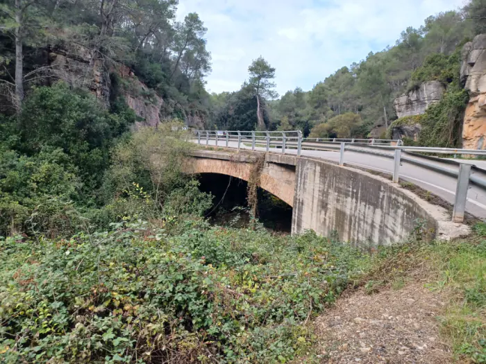
It carries a fact that matters for the next section: it was destroyed during the Civil War and rebuilt in the 1940s. This means it must be checked whether the aerial image from February 1946 shows the bridge rebuilt, under construction, or as a temporary crossing. The generic dating of "the 1940s" does not settle this question.
08 · Today
What can be seen from the airThe site seen from the air
An aerial photograph from 1946 shows what the place looked like: both slopes were terraced fields, with the road and the stream in view. Today the woodland hides much of it. That is why the old photograph is better than today's for looking for what has not yet been found: the spoil heaps, platforms and mine tracks.
Matching up the names remains to be done. There are names from 1885, from 1927 and from today, and only one link is certain: Esperanza is the mina de les Calaveres.
With the entrances located, the aerial photograph is no longer needed to find them, and instead serves another purpose: seeing what the place used to look like. The oldest coverage used is from 1946; the Series A frame covering the area is from 23 February.
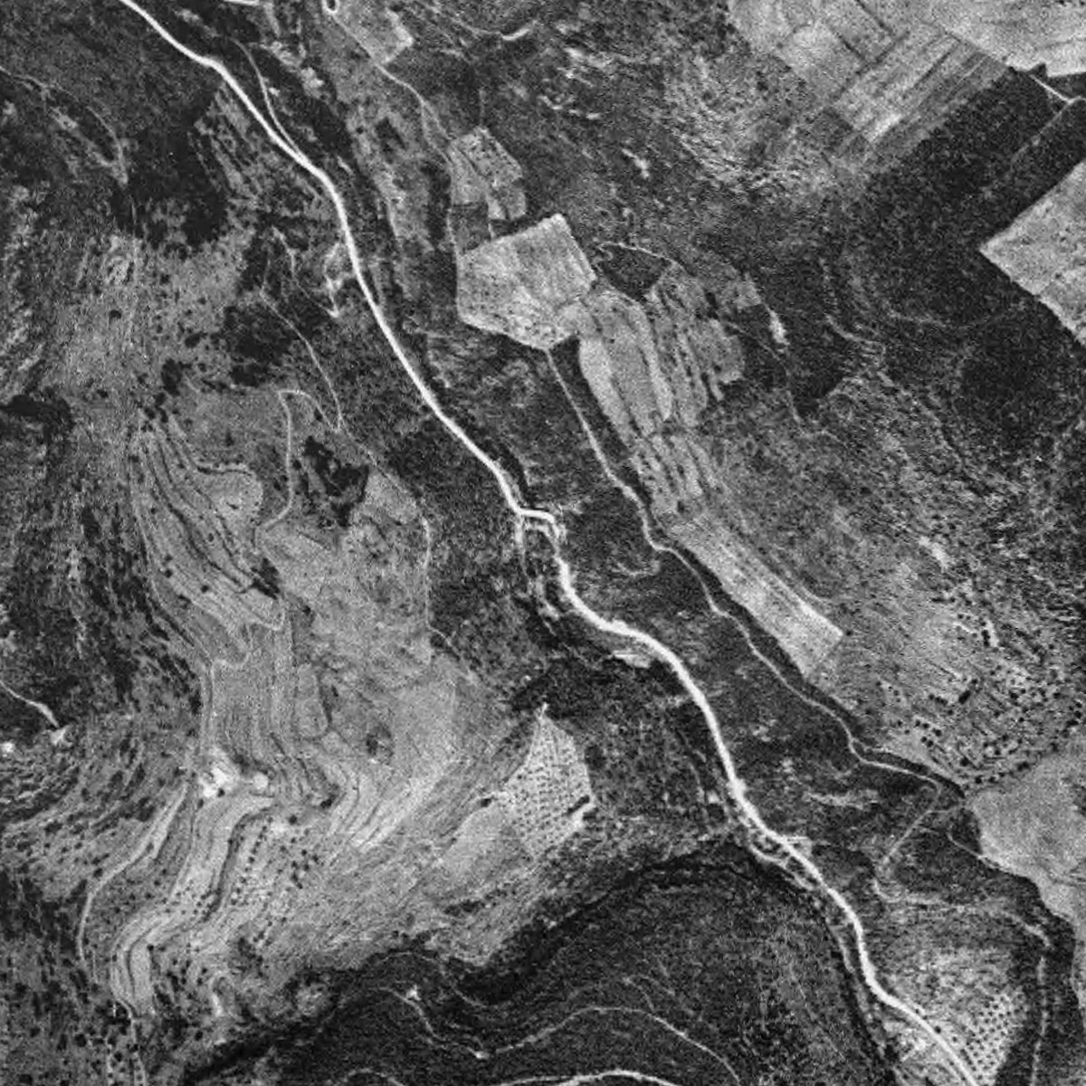
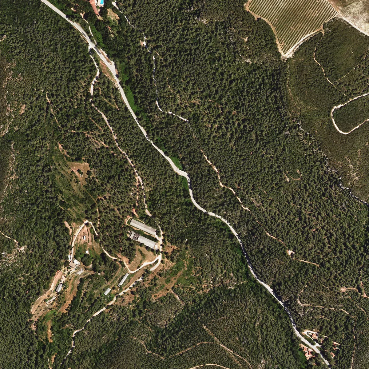
The difference is not small. In 1946 both slopes were terraced fields, open and ploughed, with the road and the streambed in view and the woodland reduced to patches. In 2025 the forest cover is more continuous and hides much of the margins and any possible remains of structures.
This has a direct consequence: the 1946 photograph is better than today's for finding spoil heaps, platforms and mine tracks, which is what remains unlocated. We already have the entrances; what surrounded them, we do not.
And there is one detail worth a closer look. The Pont de les Mines was destroyed in the war and rebuilt in the 1940s. A frame from February 1946 covers this area. It needs to be checked against the mosaic and against records of the works to establish whether the bridge had already been rebuilt; the resolution may limit what can be read from it.
And what lies beneath the woodland
The terrain model derived from LiDAR represents the relief after filtering out points classified as vegetation and buildings. It shows the terraced fields on the sunny slope, the paths, the incised bed of the stream and, to the east, the line of cliffs that Castellanos described.
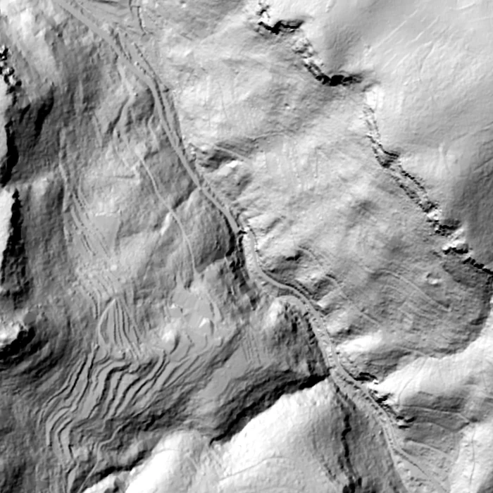
It must be said what it does not show. At two-metre resolution a mine entrance cannot be identified: the ones referred to in this study come from the heritage records, not from the LiDAR. What the LiDAR does is something else, and it is useful too: helping to recognise terraces and routes that can be compared with those from 1946.
Three and three and three
The Mindat mineralogical database describes three abandoned mines at Pontons (Mina Este, Mina Noroeste and Mina Noreste) worked "during the early decades of the 20th century" for supergene minerals, mainly calamine, in limestones and dolomites of the lower Muschelkalk. The description is consistent with the minerals and landscape in the historical accounts; it does not resolve the correspondence between mine names.
And now the problem is a different one. There are three names from Gomis from 1885 (La Esperanza, Abundante, Esperanza), three concessions from 1927 (Mascota, Mascota 2a, Teresa), three names from Mindat, three heritage records and four surveys. Only one pair is linked with certainty: Esperanza is las Calaveras. Matching the rest is a job for the mining file, and that is what remains.
What remains to be done
Several inventoried mine entrances have been identified, but they still need to be linked to the historical concessions, and what survives of the whole must be checked.
- Find the group that surveyed la Esperança in 2013. They have 1,414 metres of surveyed galleries and the full publication of their results has not been located. They could help pin down the position and condition of the cavity described by Gomis.
- Read the 1990 article. «Les mines de plom-zinc de Pontons. Estudi sobre l'antiga explotació i actuals reserves mineres», in El 3 de Nou no. 32, November 1990, pages 10 to 17. Eight pages about these mines, still unread. The records give two different authors, J. Palau for two of them and Ignasi Lizano March for one, and this too needs to be resolved.
- The Pontons Municipal Archive, which is where the request from José Cirera dated 27 August 1870 comes from, and which all three records cite as a bibliographic source.
- The mining file. The Barcelona Mining District should hold the file for the 1934 order, and those for the concessions Mascota, Mascota 2a and Teresa, applied for by Pau Lluís Weell on 15 November 1927. And, further back, the 19th-century ones: La Esperanza, Abundante and Esperanza. It is the document that would match all these names.
- The English company. The Pontons (Spain) Zinc Lead Mines Limited, which according to the caving group was formed in 1912 and wound up in 1918, dates the heritage records contradict, must have been registered in London. Dissolved British companies leave a file behind, and the annual reports or files, if they survive, could contain plans of the galleries.
- The 1297 document. The records say that James II granted the mineral rights to the monastery of Santes Creus, and that the document is held by the mine's owners. This archive has already documented Santes Creus's purchases in the municipal area in 1203, 1226 and 1230: if the document exists, it stretches that thread back seven hundred years. No edition of it has been located to check it against.
What this study does not say
- It has not gone inside any mine. Everything said about the inside comes from the heritage records and from what the cavers published in 2013.
- It does not prove that the walling-up at las Calaveres is the one from 1934. It proves that what was ordered is what has been done, which is not the same thing.
- It does not know what happened between 1889 and 1912, or when the mines changed name or owner.
- It has not matched the names. Three concessions from 1927, three names from 1885, three from Mindat, three records and four surveys, and only one certain link.
- It does not know whose bones «Las Calaveras» held, and it will probably never be known: they were smashed to pieces in the 19th century. What we do know now is that the name has survived: the mine is still called that.
What we still do not know
The mine entrances are already located, but open questions remain. For example:
- Which mine is which. The 1885 names, the 1927 concessions and today's entrances still cannot be linked, except for la Esperança, which is the one at las Calaveres.
- Whether the bone shaft still survives, and exactly where it is inside the mine.
- Whether the walled-up entrances seen today are the closure ordered in 1934.
- Whose bones «Las Calaveras» held. It will probably never be known, because they were already smashed to pieces in the 19th century.
Documentary sources and bibliography
- Cels Gomis i Mestre, Impressions de una excursió á Sant Martí Sarroca, Torrellas y Pontons. Butlletí de la Associació d'Excursions Catalana, year 1888, vol. X, pages 266 to 281.
- Josep Castellanos, Excursions per lo Penadès. Butlletí de la Associació d'Excursions Catalana, year 1890, pages 165 to 187 and 242 to 249. The excursion took place in August 1889.
- Barcelona Mining District, order of 27 February 1934. Butlletí Oficial de la Generalitat de Catalunya, no. 58, pages 1920 and 1921.
- Territorial Orthophoto and Shadow Map 2 m. Institut Cartogràfic i Geològic de Catalunya, CC BY 4.0.
- Fototeca Digital del CNIG, for identifying the frame from the American Flight Series A that covers the stretch.
- Mapa de Patrimoni Cultural de la Diputació de Barcelona, municipality of Pontons: records 08168-79 (Mines de les Calaveres), 08168-164 (Mines de Pontons), 08168-165 (Pont de les Mines) and 08168-173 (Mina de les roques del pany). Núria Cabañas, Web Cultura SCP; review of 08168-164 by María del Agua Cortés Elía, OPC. Content and photographs CC BY 4.0.
- Avanç dels treballs realitzats a les mines de Pontons (Alt Penedès). Cavitats de Catalunya blog, November 2013, with a note added on 27 December 2013.
- Mines de galena al Alt Penedès, Pontons. rejondo blog, 28 November 2016: a visit inside, with the bats and the galena still visible in the veins.
- Pontons entry on Mindat, for the geology and the modern names of the mines.
- Photographs of the two chapels and of Mas de la Riera: Angela Llop, 2012. Wikimedia Commons, CC BY-SA 2.0.
- A la riera de Pontons, Josep Salvany i Blanch, 1913. Biblioteca de Catalunya, Salvany collection, SaP_090_03. Public domain.
- Gran Enciclopèdia Catalana, Torrelles de Foix entry, for the Middle Triassic and the Muschelkalk of the municipal area.
This is the Essentials reading. The full study has 39 citations, 12 references and the documents to check it all.
Research by Amics de Foix, historical archive of Torrelles de Foix. The references make it possible to check the sources and follow the interpretations. Let us know of any correction or documentary contribution.