
Research
Torrelles from the air
The aerial photographs make it possible to see how the village has grown, how the sanctuary has changed and how the forest has taken over old terraces. We compare four coverages, from 1946 to 2025, of the same places. The first mosaic brings together winter and summer images: keeping this difference in mind helps when interpreting the landscape.
The oldest aerial photographs found of the whole municipal area of Torrelles are from 1946. Placing them alongside those from 1957, 1977 and 2025 shows how the village has grown, how the sanctuary has changed and how the forest has taken over old terraces.
1946–2025 7 references 8 citations
Research index
1946 · The flight
The first overall photographsThe photos of the American Flight
Between 1945 and 1946, the mapping service of the United States Army photographed the whole country from the air. It is known as the American Flight. The Institut Cartogràfic i Geològic de Catalunya made a mosaic from it that can be consulted free of charge. It is the oldest overall aerial view found by this research.
In Torrelles, the 1946 photos are from two days: 23 February at the sanctuary and 6 August in the village and at les Dous. Comparing two places can mean comparing winter with summer.
Between 1945 and 1946, the United States Army Map Service carried out a countrywide aerial photography campaign, at an approximate scale of 1:43,000, in black and white. It is the American Flight Series A. The Institut Cartogràfic i Geològic de Catalunya has obtained scanned copies through an agreement with the Ministry of Defence and has produced an orthophoto from it: a mosaic of rectified photographs that allows coordinates to be placed and distances measured, within the product's precision limits.
The cropped views of the municipal area used here come from the 1946 and 1957 layers. The equivalent queries for 1945 and 1956 returned empty images at the sanctuary. This check identifies the available coverages, but the exact date must be looked up in the record for each frame.
The subsequent search in the Fototeca Digital del CNIG has identified nine frames from 1946 covering points in the municipal area, spread across three passes and two dates. The frame of the sanctuary is from 23 February; those covering the village and les Dous are from 6 August. There are also photographs from two days in 1957: 19 April and 1 July.
Four coverages for reading the landscape
- 1946Winter and summer
23 February at the sanctuary; 6 August in the village and at les Dous. Series A.
- 1957Spring and summer
Frames from 19 April and 1 July. Series B.
- 1977More detail
Coverage from the inter-ministerial flight, in black and white.
- 2025The recent landscape
Colour coverage from the ICGC.
A mosaic is not a photograph of a single moment. Vegetation and shadows change with the season. Comparing the north and south of the municipal area in 1946 can mean comparing winter with summer. It is also necessary to check which frame was used in each sector of the mosaic.
The oldest images found of the municipal area are photographs from 1 April 1906, kept at the Arxiu Nacional de Catalunya, and the postcards start around 1910. The 1946 coverage is the oldest overall aerial view found in this research: it also makes it possible to study fields, ponds and paths that are poorly represented in photographs taken from the ground.
The ICGC's orthophotos can be viewed and downloaded free of charge under a Creative Commons Attribution 4.0 licence, citing the source and the date.
Compare the same place across two years
Choose one of the ten places and move the slider. The year buttons, in the corners, let you choose the two coverages. All the comparators on the page offer this change of year. With the control selected, you can also move the slider with the keyboard arrows.
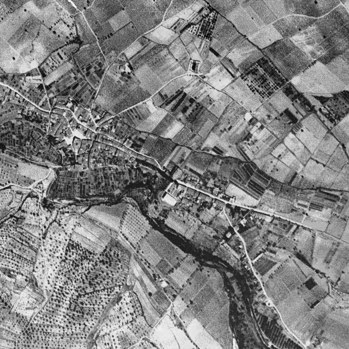
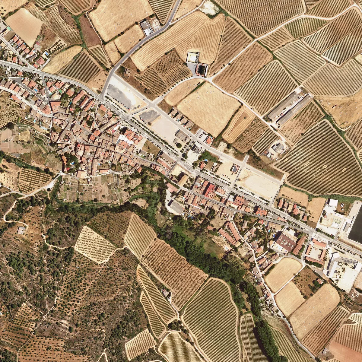
The ICGC warns that a strip of the 1945-1946 coverage is completed with later images. The eighteen crops examined from 1946 and 1957 show differences, but this comparison is not enough to rule out any localised substitution. Dating a building also requires checking the original frame.
1946–2025 · The sanctuary
The sanctuary before and after the restorationThe sanctuary, before the works
In the 1946 and 1957 photos, the sanctuary of Santa Maria de Foix is just a light patch at the top of the ridge. The 1977 one has more detail and already lets the walls and the floor plan be distinguished better. All three are from before the restoration, which began in October 1982.
That said: if something does not show up in the oldest photo, that does not mean it was not there. The image may simply lack enough detail.
In the 1946 and 1957 crops, the sanctuary of Santa Maria de Foix appears as a light patch on the ridge. The 1977 image allows the walls and floor plan of the complex to be distinguished better. This difference in detail means that what is not visible in the oldest flight cannot automatically be read as absent.
The photographs predate the documented restoration works: the first phase runs from 13 October 1982 to 29 April 1983; the second reaches April 1984, and excavations take place in 1985. The celebration on 20 April 1987 still takes place with the works under way.
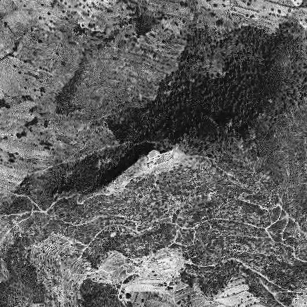
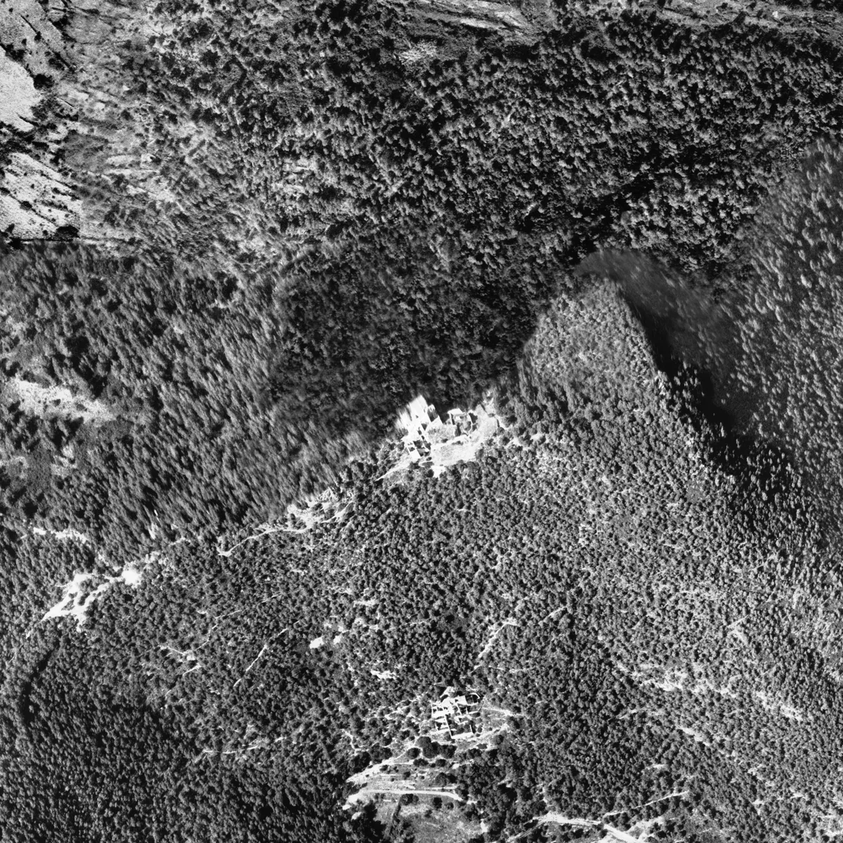
Change one of the years to 2025 to see the current roof, esplanade and access path. To learn about the state of the building before the works, also see the ground-level photographs and reports gathered in the research on the sanctuary.
1946–2025 · The village
The village before it grewHow the village has grown
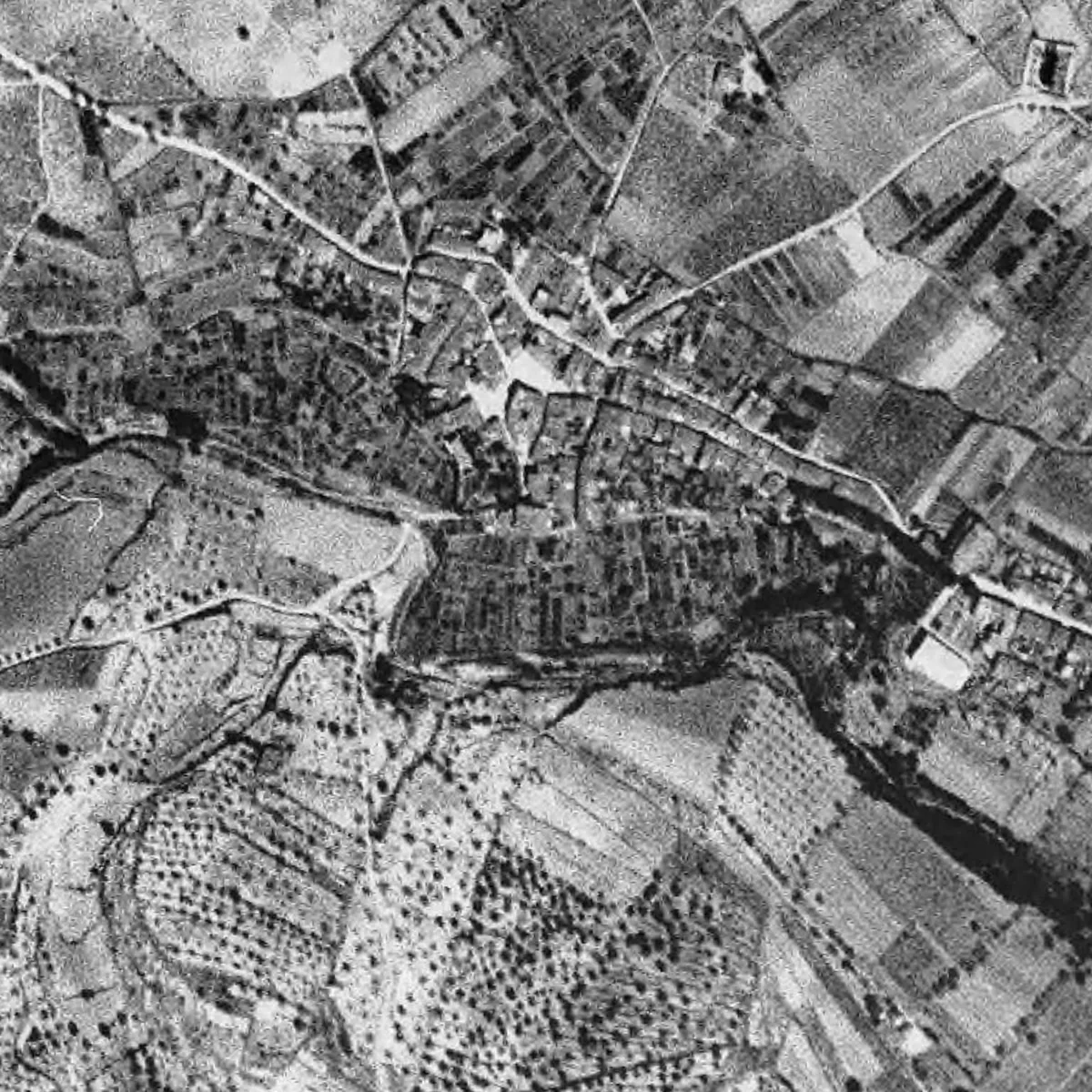
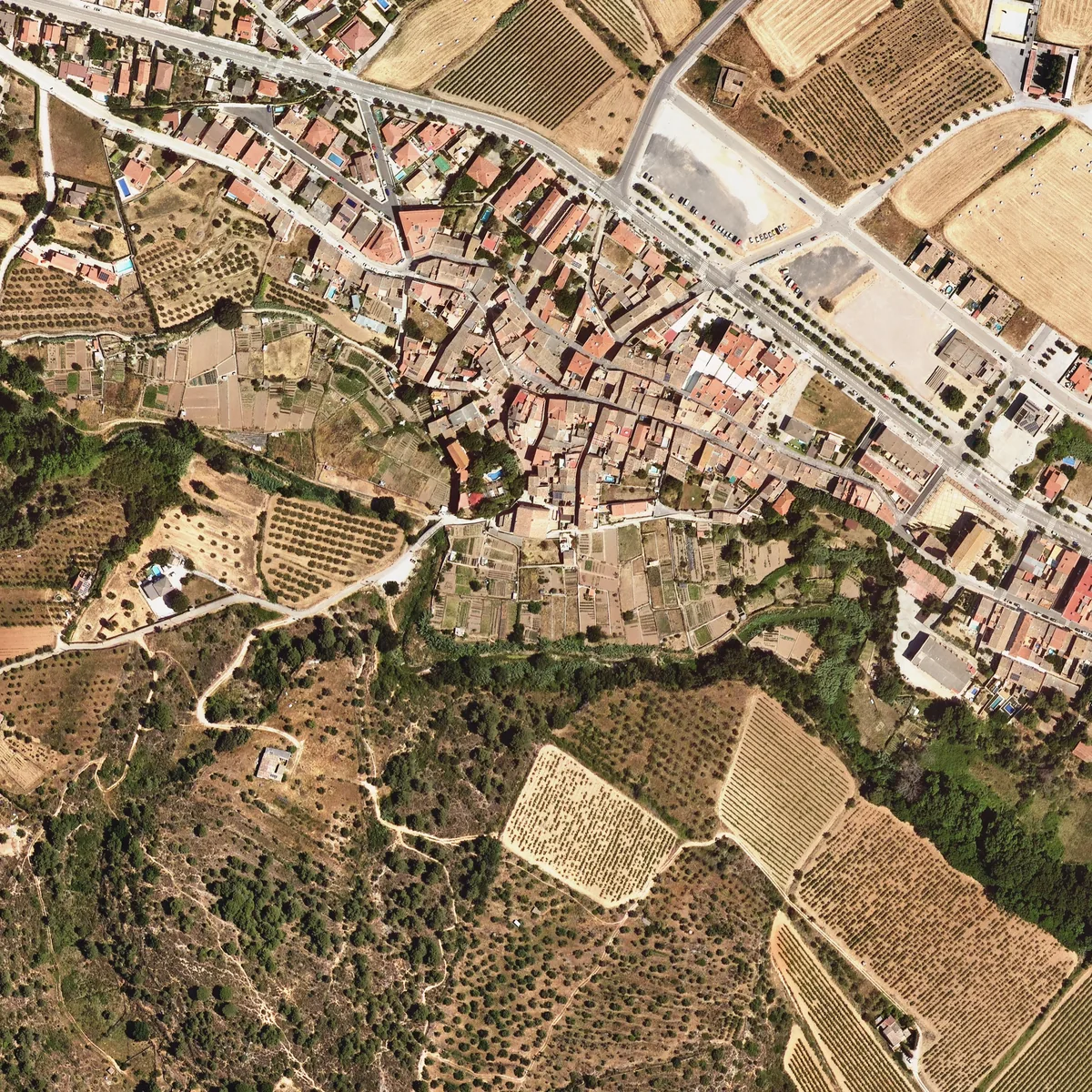
In 1946 the village was a compact cluster, surrounded by fields. By 1977 its growth is already visible, and today it is larger, especially to the north and east. Beside the stream, many vegetable-garden terraces that could be seen in 1946 are now covered with scrub and trees.
Two large housing developments in the municipal area are another story: according to the Diputació's catalogue, la Plana de les Torres dates from 1962 and Can Coral from 1972. They need to be studied separately from the village.
In 1946 the cluster is compact and surrounded by fields. By 1977 the expansion is already visible, and the 2025 image shows a larger built-up area, especially to the north and east. The visual comparison allows the growth to be recognised, but not quantified without delimiting and measuring the areas.
Across the whole municipal area, the Diputació's catalogue dates two large housing developments: la Plana de les Torres in 1962 and Can Coral in 1972. They are different processes from the growth of the village centre and must be studied separately.
Along the banks of the stream, many of the vegetable-garden terraces visible in 1946 and 1957 appear covered with scrub and trees in 2025.
1946–2025 · The cropland
The terraces the forest has taken overFrom cropland to forest
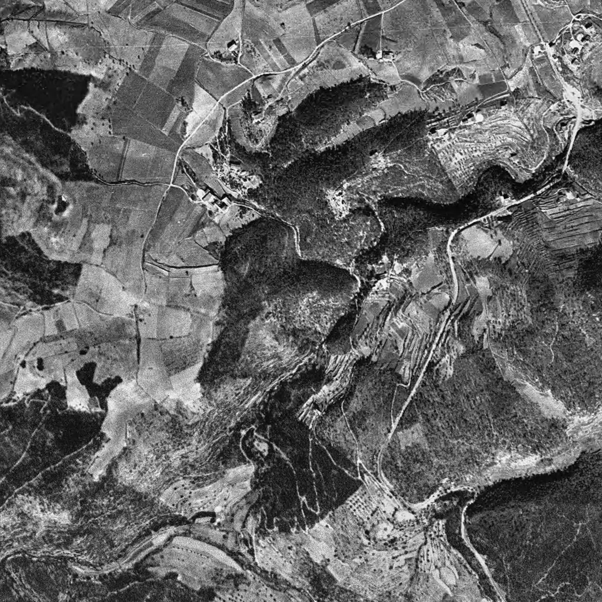
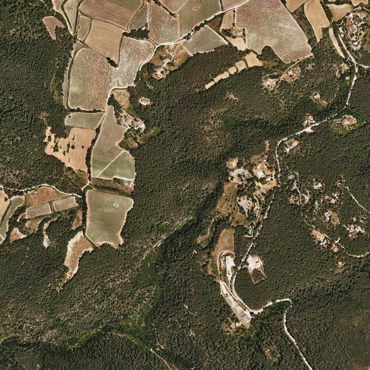
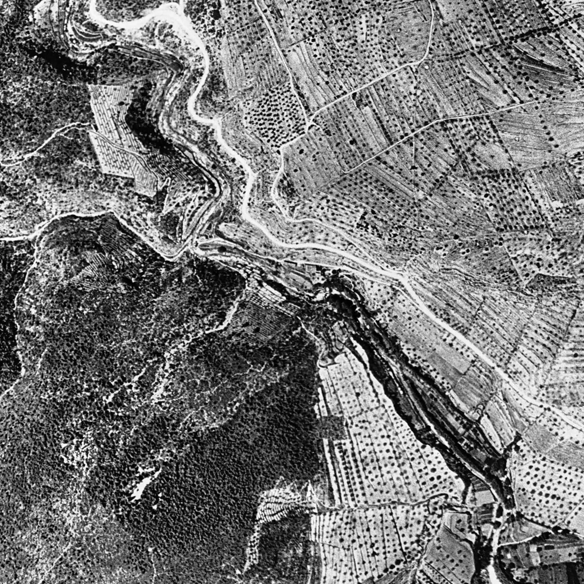
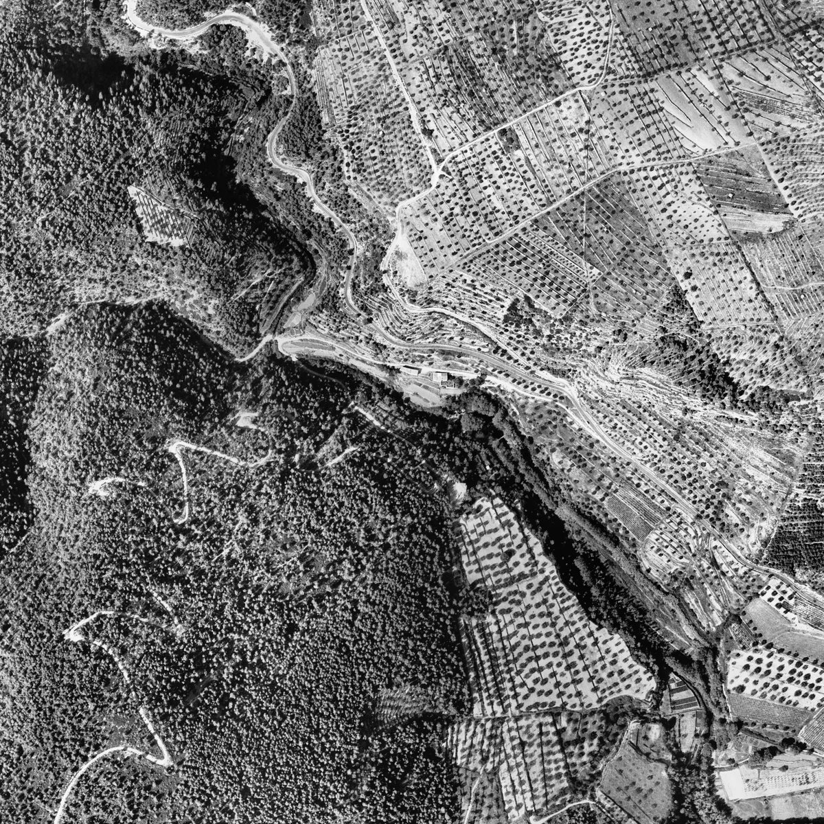
At Secabecs and at les Dous, the 1946 photos show cultivated terraces on the hillsides. In 2025, these hillsides have a more continuous forest cover. This suggests that some crops were abandoned and that the forest has gained ground.
But the photos do not allow us to say that the whole municipal area was ploughed, nor how much forest has been gained. Nor do they mean, on their own, that the municipal area lost population: to find that out, censuses and other documents must be consulted.
At Secabecs and at les Dous, the 1946 flight shows terraces on hillsides that in 2025 have a more continuous forest cover. The margins and shapes of the fields allow part of that agricultural landscape to be recognised.
This observation points to the abandonment of some crops and the expansion of the forest. It does not allow us to state that the whole municipal area was ploughed, nor to establish what proportion of forest has been gained. Land uses would need to be mapped, and the seasons of the frames taken into account.
A change in landscape does not directly equate to depopulation either: to relate it to population or to agricultural activity, the images must be checked against censuses and other documents.
1946–2025 · The plots
Bigger fields and more regular rowsBigger fields
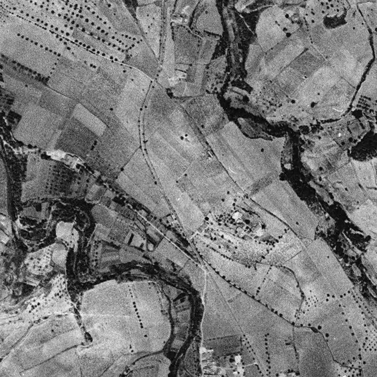
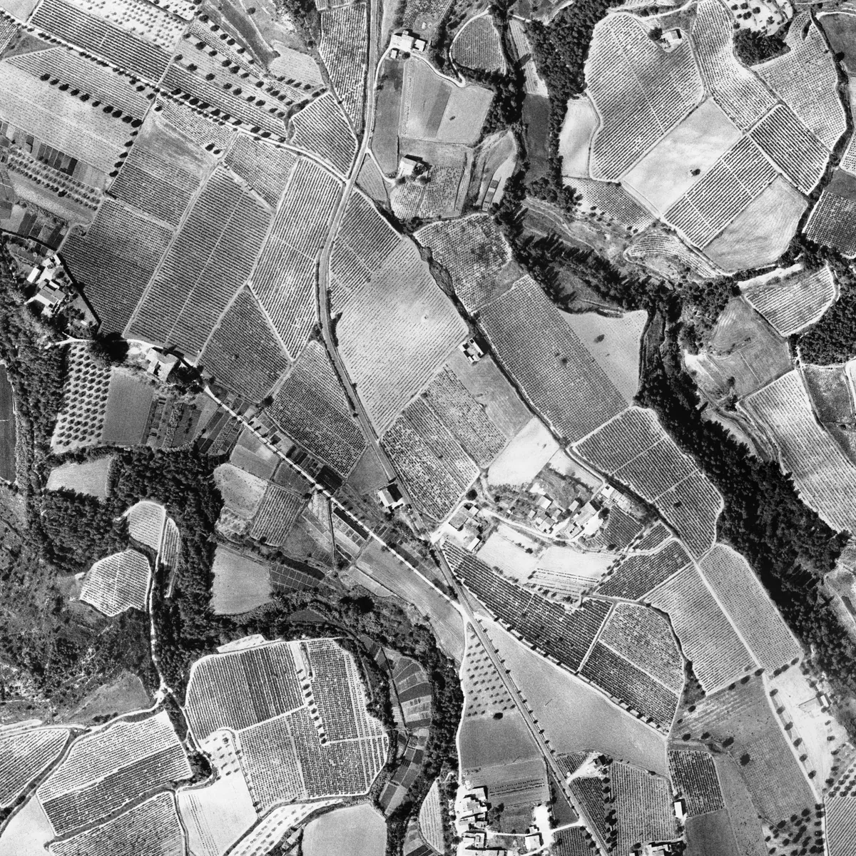
At el Terme, next to the new chapel and the cemetery, the 1946 photo shows a mosaic of small, irregular fields. By 1977 and 2025 larger plots and more regular rows can be seen, which fit with changes in the way the vineyard was worked.
The photo, however, does not explain on its own the inheritances, the ownership, or which plots were merged: that must be looked up in land registries, deeds and other agricultural documents.
At el Terme, next to the new chapel and the cemetery, a mosaic of small, irregular fields can be seen in 1946. By 1977 and 2025, larger cultivated plots and more regular rows can be made out, consistent with changes in the way the vineyard was worked.
The photograph shows the shape of the crops, but it does not explain on its own the inheritances, the ownership, or land-consolidation operations. These processes must be checked in land registries, deeds and agricultural records.
Method
What each image allows us to seeWhat can be seen, and what cannot
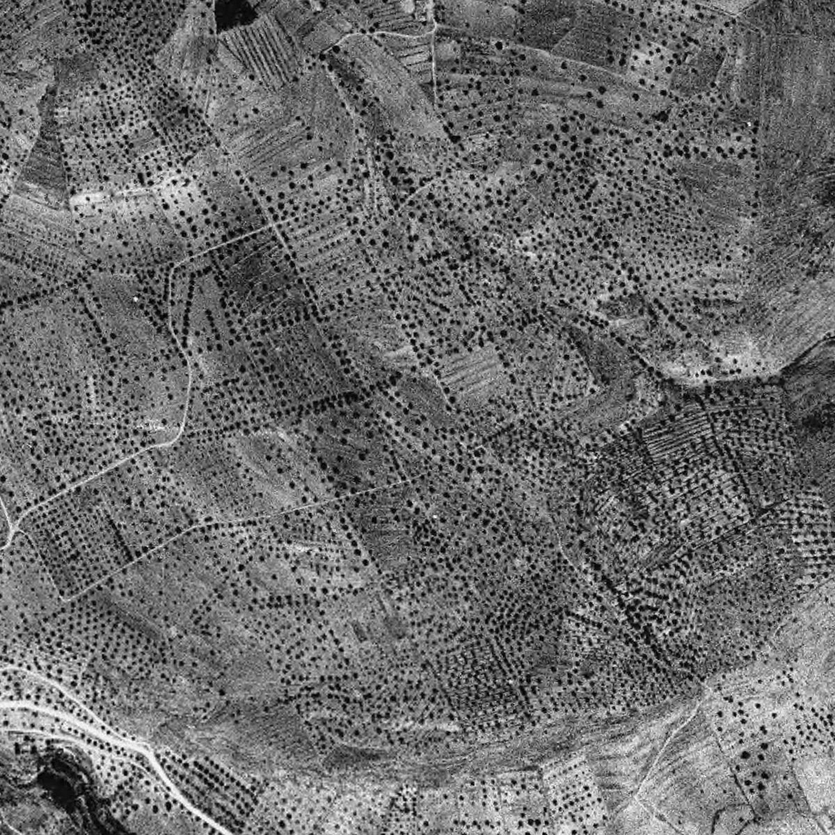
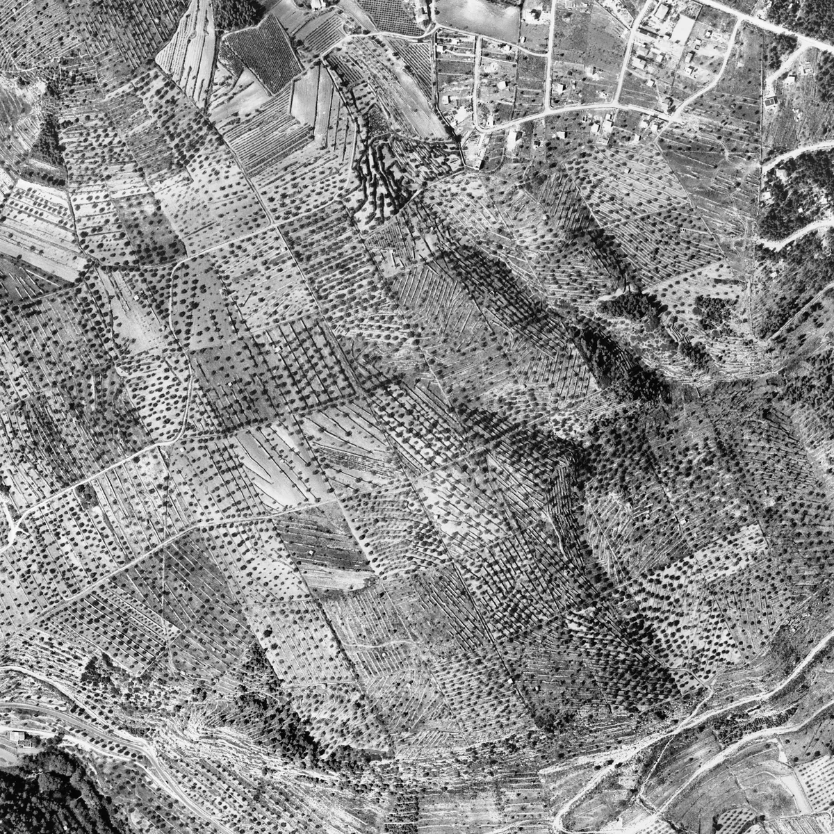
In the 1946 photo, each pixel (the smallest point in the image) is equivalent to one metre of ground. Terraces, paths and rows of trees can be seen, but a dry-stone hut at les Planes, whose location is known, cannot be reliably made out. The 1977 one has more detail and is better for looking for dry-stone structures.
For this reason, a building not appearing in the photo does not prove that it did not yet exist. And zooming in on the screen does not add any detail.
Pixel size, contrast, shadows and vegetation determine the visible detail. The test carried out on a dry-stone hut at les Planes, whose location is known, helps to understand these limits.
| Year | Pixel | Guidance for reading |
|---|---|---|
| 1946 | 1 m | Terraces, paths and rows of trees. The hut examined cannot be reliably identified. |
| 1957 | 50 cm | Margins and rows more defined; the hut remains at the edge of identification. |
| 1977 | 25 cm | More detail of the trees and of some small structures, if visible. |
| 2025 | 25 cm, colour | Colour helps to distinguish ground cover; forest and shadows can hide remains. |
The 1946 layer used is the one-metre one, according to the manifest for preparing the images. The ICGC also advertises the historical coverage at 50 cm: the resolution of the available layers should not be confused with that of the specific file shown. Zooming in on screen does not create new detail.
Two ways of reading the same photograph
We see a path, a roof, or a terrace.
We propose a function or a date for it, which we check against other images and documents.
For studying the landscape, the 1946 flight is an especially valuable reference. For looking for dry-stone structures, the 1977 one offers more detail in the crops used. The absence of a structure in the image does not prove that it did not yet exist.
What remains to be checked
The exact correspondence between frames and mosaic. The February and August 1946 dates have already been located. The boundaries of each frame need to be traced, and which one was used in each sector identified, before assigning it a precise date or interpreting its shadows and crops.
The function and date of the path at les Dous visible in 1977 and not identified in the earlier flights.
Which huts already existed. The Wikipedra extraction from September 2026 lists 236 huts in the municipal area. They can be checked one by one against the flights, without taking a lack of visibility as proof that a hut was not there.
What we still do not know
The aerial photos answer many questions, but raise others. For example:
- Which day each part of the 1946 mosaic is from. There are photos from February and August, and it is still necessary to find out which one was used at each place.
- When it was made and what it was for, the zigzag path at les Dous, which can be seen in 1977 and has not been identified in the earlier flights.
- Which of the 236 huts in the municipal area listed in the Wikipedra inventory were already there when these photos were taken.
Documentary sources and bibliography
- ICGC Ortofoto Territorial: features, historical coverages and licence
- Ortofoto Territorial WMS service
- Fototeca Digital del CNIG: dates and identifiers of the frames
- Fototeca de Catalunya, ICGC
- Reports of the Servei del Patrimoni Arquitectònic Local: restoration of the sanctuary
- Wikipedra: inventory of dry-stone structures
- Extraction and manifest by Amics de Foix: vol-america-1946 and frames from 1946 and 1957, September 2026
This is the Essentials reading. The full research has 8 citations, 7 references, and the documents to check it all.
Research by Amics de Foix, historical archive of Torrelles de Foix. The references make it possible to check the sources and follow the interpretations. Let us know of any correction or documentary contribution.